(GR
351 452 )
Directions to point K
The next point is the village of High Moorsley. The footpath doglegs through the fields in a north-west direction for 1.25 miles often running alongside hedges. It slowly climbs and as it does it offers fine views over the countryside to the north and the village of Hetton-le-Hole. As the path nears the end you should be able to make out a large white “golf ball”; this is a scientific site established by Northumbrian Water to gather meteorological information. There is no need to go right up to the site as the path turns sharp right and starts to go downhill to High Moorsley a 500 metres to the north. After running alongside a group of trees on your right you will emerge on to the Moorsley Road. Across the road is a small group of bungalows called Valley View which have a captivating view north as far as Newcastle.
( Point K) GR 338 459) QR code or link to information.
Heritage Information Point J
The trees on the right have been planted within the last 50 years. Originally this location was where there were a number of streets of miners’cottages. They were named as First Row, Second Row and Third Row. On the other side (uphill side) of the track were Westgarth’s Row and Wade’s Row, altogether about 50-60 properties. The cottages were typical miner’s accommodation with two rooms on the ground floor and an attic space which served as a bedroom area. There was no running water to most of the properties but there were stand pipes at the end of each street. In winter time these pipes often froze and inhabitants had to get good clean water from a spring down the hill from the present Valley View. Near to this group of houses were two pubs, The Crown Inn and the Lamb Inn. The latter pub building is now a private house and is the white house a little uphill from the track and set back off the road. The limestone cottages were demolished during the 1960s and early 1970s and trees planted in their place.
The township of Moorsley was first mentioned during the reign of Henry II (1154- 1189) as Moreslav or Moreslawe. At this time the land was given to the Prior and Monks of Durham Cathedral by the owner, Adam de Moreslawe. He was admitted into the Prior’s household and his wife was given a toft and 2 acres of land rent free. By 1821 there was just 7 inhabited houses accommodating 10 families. Eight of the families were employed in agriculture, one in craft work and a single independent family giving a total of 48 people in all. Ten years later the population had grown to 748 due to the opening of local collieries including Moorsley or to give it its proper name, North Hetton.
|
|
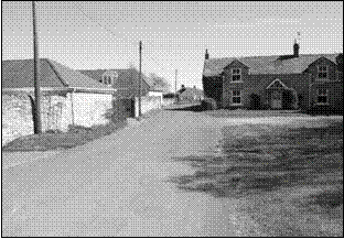
Farmhouse and buildings at Hetton-on-the-Hill |
|
|